Is the Central Valley in a drought? The answer is that the entire state of California is in a drought, but the drought conditions in the Central Valley continue to significantly worsen.
Drought is a recurring feature of the climate in California. Over the past 20 years, the state has experienced three stretches of short-term drought: 2000-2003, 2007-2009, and 2012-2016.
However, the drought that has been plaguing the western part of the country, including California, ranks as the driest 22-year period in at least 1,200 years. Scientists who have been measuring historical moisture patterns by studying tree rings have come to the conclusion that the West is in a “megadrought” which has been made worse as a result of climate change.
Approximately 75% of California’s annual precipitation – rain, snow, and hail – falls from November through March, with most of the precipitation falling in December – February as a result of large winter storms called “atmospheric rivers.” The state’s ongoing drought is the result of lack of rainfall/snowfall, higher average temperatures, and drier air masses in the atmosphere.
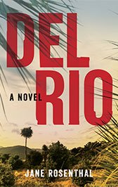
Jane's second novel!

A once-thriving Central Valley farm town, is now filled with run-down Dollar Stores, llanterias, carnicerias, and shabby mini-marts that sell one-way bus tickets straight to Tijuana on the Flecha Amarilla line. It’s a place . . .
Perhaps nowhere in the state are the effects of the persistent drought conditions being felt like they are by the farmers, ranchers, and residents of the Central Valley. According to the U.S. Drought Monitor, most of the Central Valley is experiencing extreme to exceptional drought conditions; parts of Fresno, Tulare, Kings, Merced, and Mariposa counties currently fall under the category of exceptional drought.
As a result, Valley farmers and ranchers have been significantly impacted as a result of having their water resources reduced; Fresno is currently on a three-day watering schedule, with water restrictions already in place in some parts of the Valley.
The range of drought measurements
According to ArcGIS.com, the intensity of a drought is classified according to the deviation of precipitation, stream flow, and soil moisture content from historically established norms.
The U.S. Drought Monitor uses 5 classifications or levels of drought when putting together their weekly drought monitor map of the country:
- D0 Abnormally Dry
- D1 Moderate Drought
- D2 Severe Drought
- D3 Extreme Drought
- D4 Exceptional Drought
According to the most recent map released on August 4, 2022, the Central Valley of California is classified as experiencing extreme drought conditions with pockets of the Valley experiencing exceptional drought conditions.
Praise for the writing
Conserving water for the greater good
The Central Valley of California is the state’s most productive agricultural region and one of the most productive in the world. Unfortunately, farming and food production in the Central Valley of California are extremely vulnerable to the extreme drought and exceptional drought conditions resulting from climate change as well as the tremendous demand for water for agricultural use.
While water restrictions are a very short-term option for conserving water, farmers, ranchers, and Valley residents are going to have to consider other more long-term ways to conserve water as well as planning for the impacts to the area that have already resulted from this drought.
Consider the Central Valley town of Corcoran. Why is this town in the San Joaquin Valley sinking due to persistent drought conditions?
